Humboldt Range Gold-Silver Project, Nevada
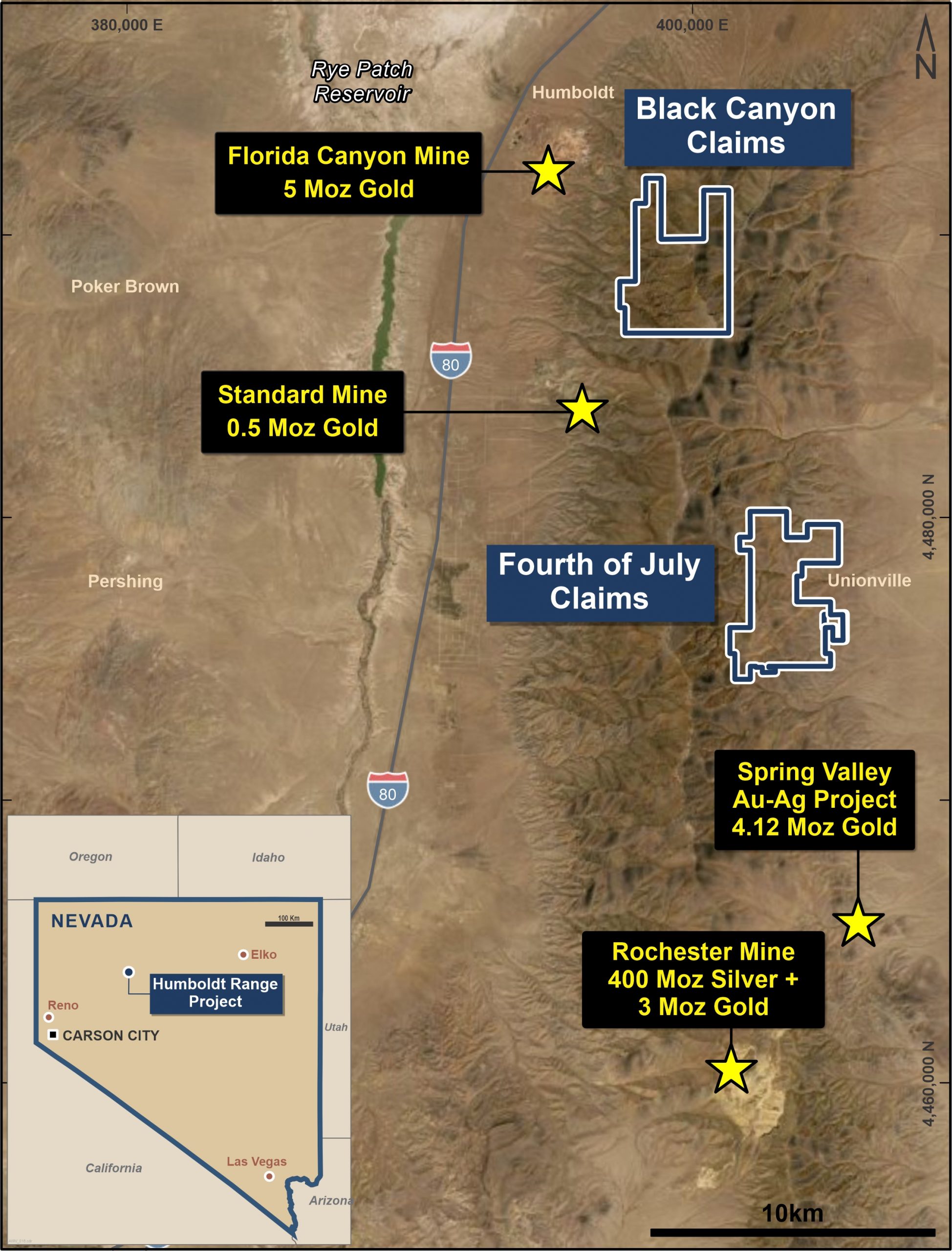
Figure 1. Location map depicting Black Canyon and Fourth of July Claim Blocks, and nearby large-scale gold-silver mining operations.
Highlights
The Humboldt Range Project currently comprises 364 lode mining claims in Nevada in two claim groups: Black Canyon and Fourth of July and is situated between two large-scale active mines: the Florida Canyon gold mine and the Rochester silver-gold mine (see Figure 1), and adjacent to the rapidly growing 4Moz+ Spring Valley Gold Project. Access to the project is straightforward via roads off the I-80 Interstate Highway, which lies less than 15km to the west of the claims.
Humboldt Range contains geology consistent with bonanza-style epithermal gold-silver mineralisation and bulk mineable epithermal gold-silver mineralisation, both of which are well known in Nevada.
Widespread narrow vein mineralisation with visible gold occurs within the claims and was historically mined via numerous adits and underground workings between 1865 and the 1927. Mineralisation occurs in swarms of high-grade epithermal quartz veins of varying thickness (reported from 1cm to 3m), either as isolated veins or as broad zones of sheeted/anastomosing veins within zones of intensely altered and mineralised host rocks.
Nevada, USA was rated as the world’s best mining jurisdiction in both 2021 and 22. It hosts some of the world’s most successful Gold, Silver and Copper mines with a mining and environmental framework supportive of best-practices mining. Nevada yields over 75% of USA’s total annual gold production.
PolarX acquired the project in 2021, extended it twice and immediately conducted the first comprehensive soil sampling program in almost a century.
Black Canyon (Gold dominant)
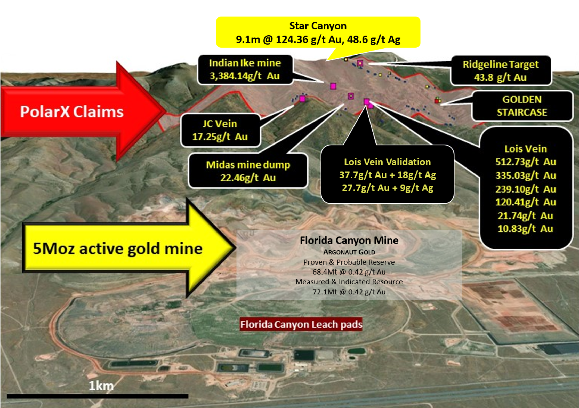
Black Canyon is at the northern end of Humboldt Range and is less than 3km from and overlooks the currently operating Florida Canyon Mine, which hosts 5Moz Gold.
Exceptionally high-grade assays from PolarX’s soil sampling outlined very large coherent anomalies ranging from 1.3km to 2.3km long which the Company plans to drill-test. Early indications are compelling.
Highlights:
- Soil assays of up to 793ppb gold and rock-chips assays of up to 512.7 g/t gold in quartz veins from old mine workings within the soil anomalies.
- Three significant gold anomalies greater than 50ppb gold in soils measure over 1.3km long.
- The largest, eastern anomaly measures 2.3km by 0.8km and contains up to 793ppb gold in the soils and up to 43.8g/t gold and 86.1g/t silver in rock-chip sampling in extensive quartz veins within the soil anomaly.
- The western anomaly measures 1.3km x 0.3km and contains up to 245.9ppb gold in the soils. At its northern end lies the Lois Vein system where several rock chip samples assayed over 100g/t gold, with a peak value of 512.7g/t gold in a 30cm wide quartz vein.
- The southern anomaly measures 1.4km x 0.5km with a peak value of 697.9ppb gold in the soils and up to 4.49g/t gold in rock-chip samples associated with multiple narrow quartz veins.
The geochemical soil sampling anomalies coincide with mapped geological structures and known mineralised quartz veins but have also highlighted additional areas for further evaluation.
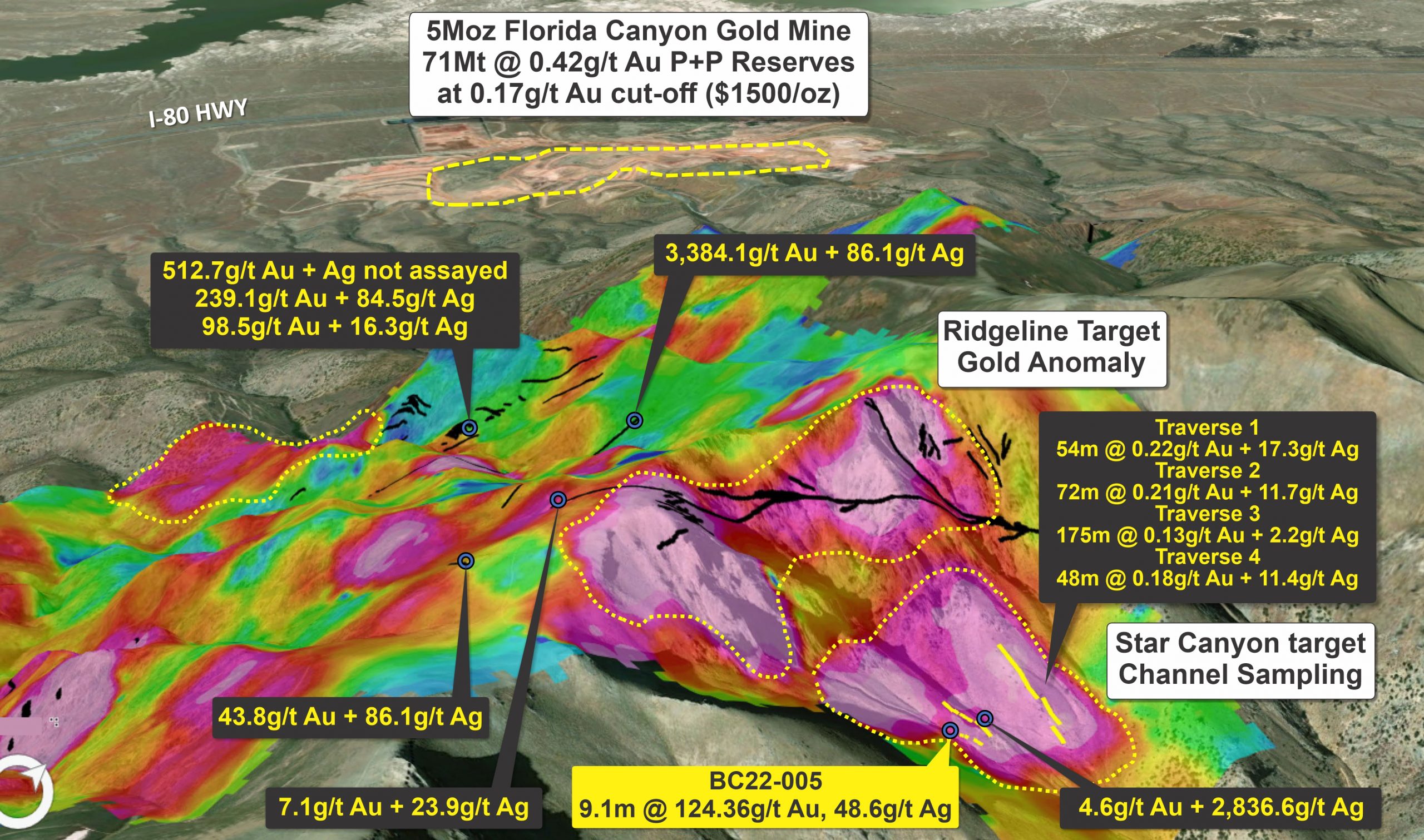
Figure 2. Gridded image of gold in soil sampling overlain with rock-chip sample assays, labelled where >2g/t gold.
First drilling by Polarx during 2022 yielded gold and siver in every hole drilled at 200m wide intervals. Holes were only drilled to 100m depth.
Results included bonanza grades (9.1m @124.36g/t gold + 48.6g/t silver), within an extremely broad mineralised system.
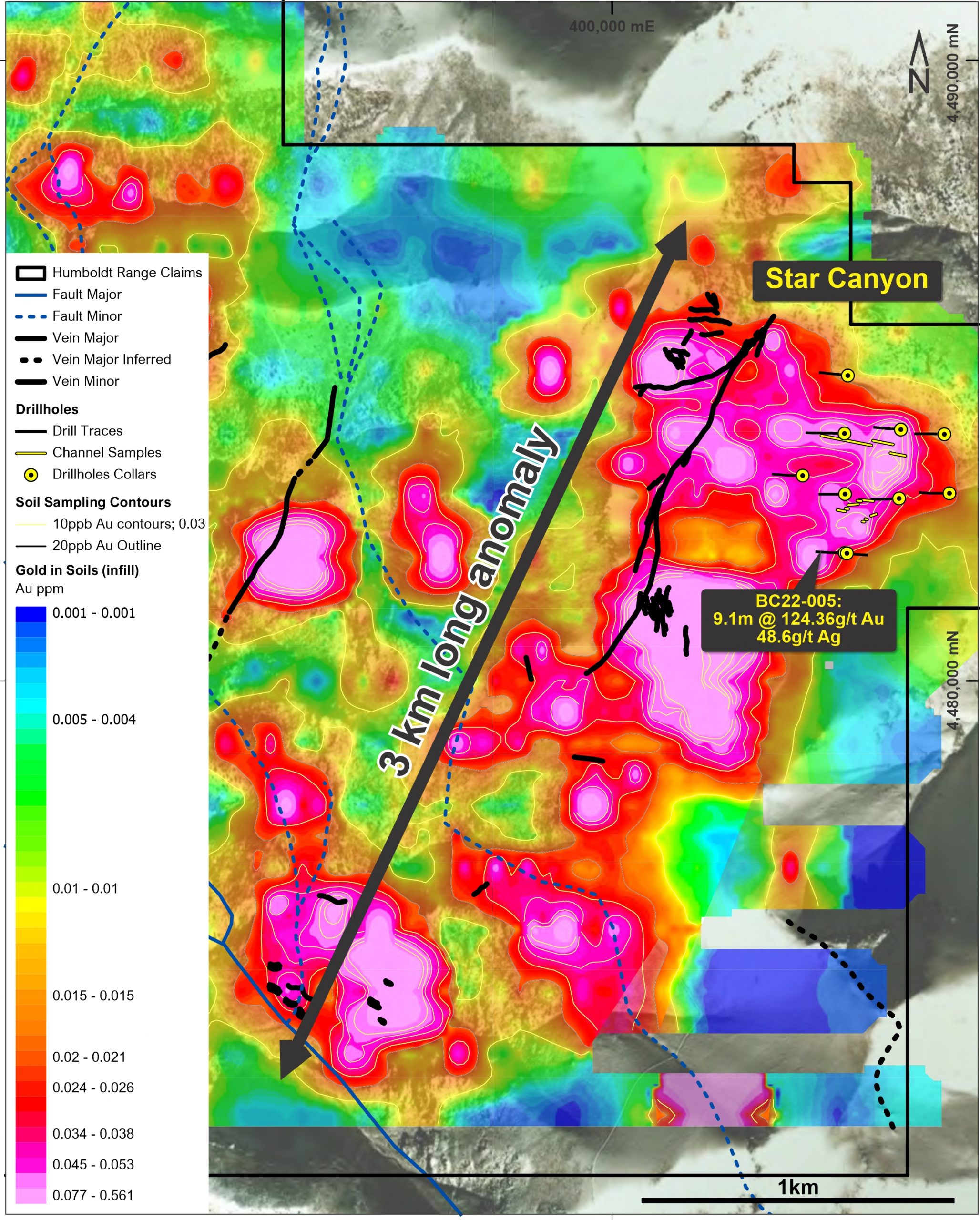
Eastern anomaly: is the largest soil anomaly and measures 2,300m long and 800m wide. This anomaly is associated with outcropping mineralised quartz veins on a steep east facing slope which has never been previously sampled. The vein system has been mapped over a length of at least 1,300m with veins samples from its southern end assaying 7.8g/t gold. Another vein 250m away returned an assay of 43.8g/t gold from a narrow quartz vein associated with old workings.
Maximum gold-in-soil values of 793.1ppb and 782.1ppb occur in this anomaly. The eastern part of the soil anomaly has no outcropping quartz veins but does contain minor historic workings.
The western and southern soil anomalies each exceed 1,300m length and are between 300m and 500m wide. Key attributes of each are:
Western anomaly: 1300m x 300m, peak value of 245.9ppb gold-in-soils, with narrow quartz veins in the Lois Vein area assaying 512.73g/t, 335.03g/t, 239.1g/t, 120.41g/t, 37.7g/t, 27.7g/t, 21.7g/t, 10.83g/t gold.
Southern anomaly: 1,400m x 500m, peak value of 697.9ppb gold-in-soils, with gold-bearing veins on the south-west edge of the anomaly up to 4.49g/t gold.
In 2022 PolarX cut a channel across the Golden Staircase veins from surface which assayed a continuous 69m @ 1.1g/t gold plus 7.65g/t silver. This target warrants early drilling.
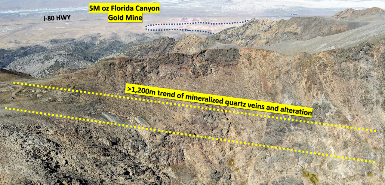
Each of these three anomalies has large scale which may indicate bulk-mineable targets like the nearby 5m oz Florida Canyon Gold Mine, which lies within only 3km to the NW (Figure 3).
Figure 3. Oblique 3D view of the Black Canyon claims showing gold grades in g/t and proximity to the large 5Moz Florida Canyon gold mining and heap leach operation – within only 3km to the west of PolarX’s claims.

Fourth of July (Silver Dominant)
Fourth of July is at the southern end Humboldt Range and is less than 15km from the impressive and currently operating Rochester Mine, which hosts 400Moz silver and 3Moz gold (Figure 1 ).
Highlights:
- The largest silver anomaly is broadly defined as >0.5g/t silver in soils and is over 3.5km long, up to 2km wide and with a peak value of 186g/t silver.
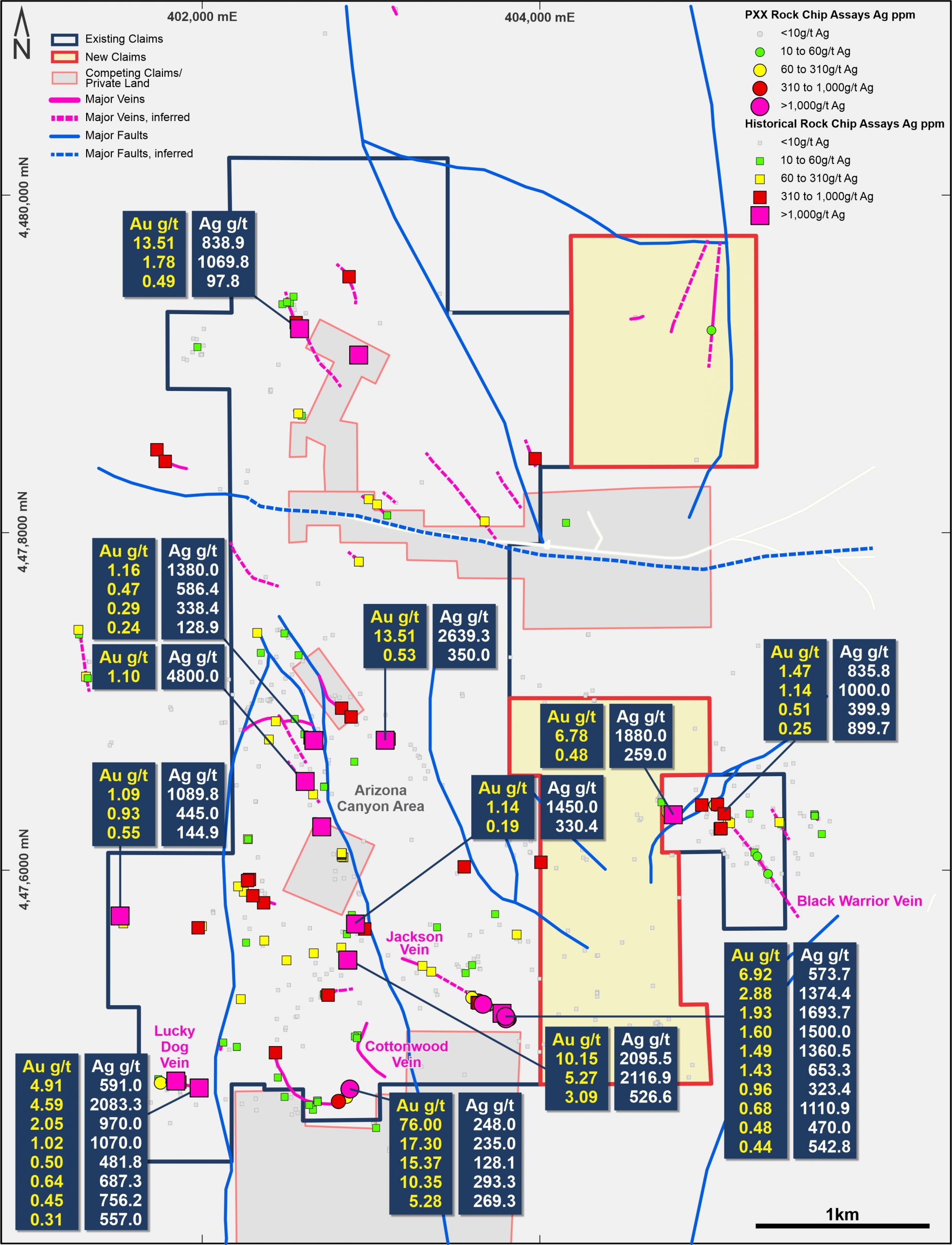
- Multiple rock-chip samples collected from veins within this very large silver anomaly assay over 60g/t silver, with eight samples > 1,000g/t and a peak value of 4,800g/t.
- Multiple gold in soil anomalies are also present, both associated with the large silver anomaly and in several stand-alone anomalies associated with known veins or extensions of known structures, or newly defined targets.
- Peak gold-in-soil anomalism is 413ppb gold, with anomalism >20ppb gold considered to be highly significant.
The geochemical soil sampling anomalies coincide with mapped geological structures and known mineralised quartz veins but have also highlighted additional areas for further evaluation.
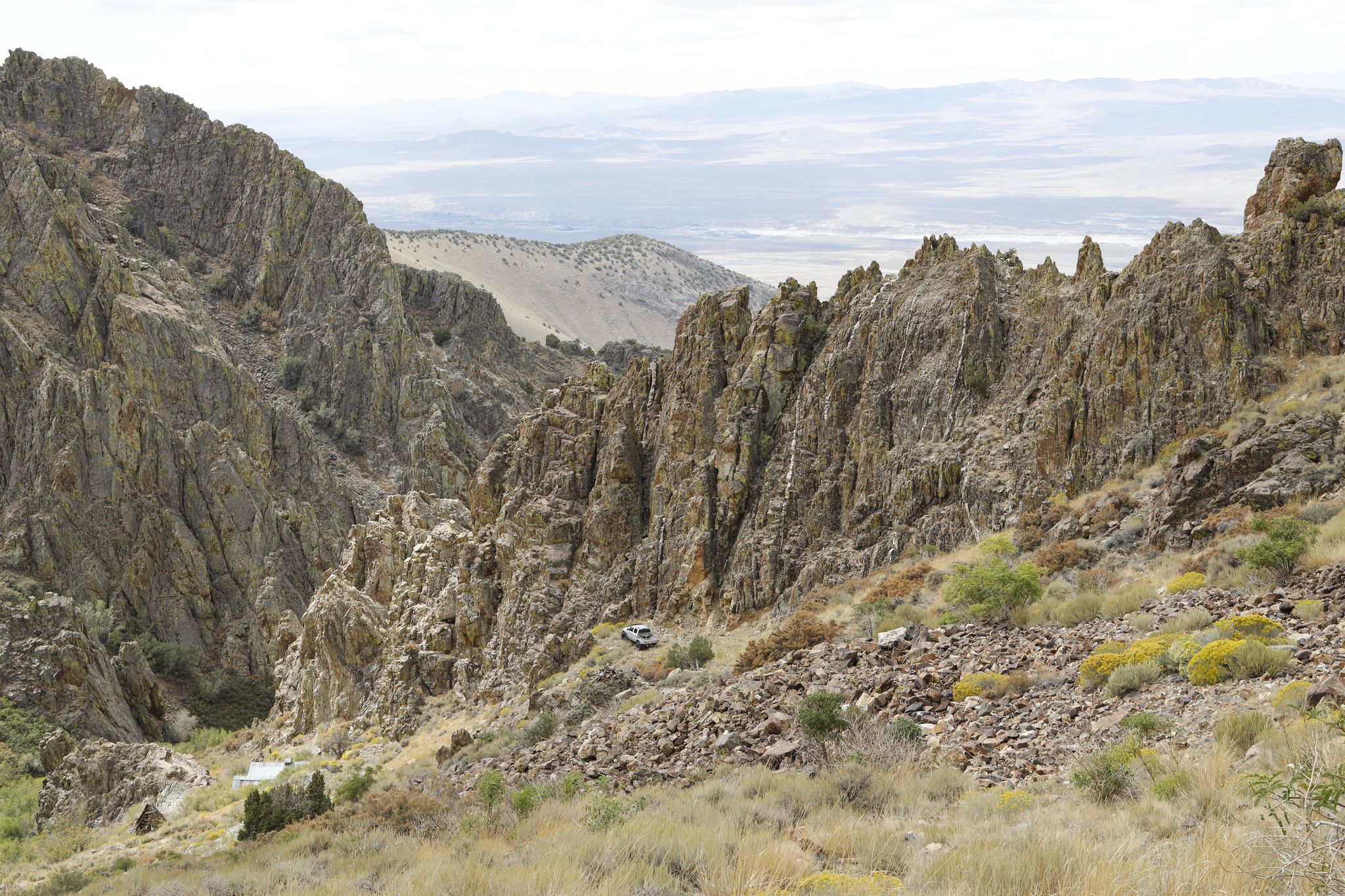
Mineralised quartz veins
PolarX’s Soil Sampling
Soil sampling on an E-W 200m x 50m grid was conducted by PolarX during 2021 covering most the Fourth of July claims in the Humboldt Range Project. This program complements detailed soil sampling previously undertaken by Renaissance Exploration Inc over part of the project area in 2014/2015, which has since been validated by PolarX and incorporated into the project database (refer Appendix 1 JORC Table 1).
Silver
A prominent, large silver anomaly occurs in the south-west part of the claims (Figure 2), associated with two major N-S striking faults which form the Arizona Graben. The silver anomaly is over 3.5km long, up to 2km wide and has a peak value of 186g/t silver in the soils. Rock chip samples from quartz veins within the anomaly (reported to ASX on 27 May 2021) show high to very high levels of silver, with many samples containing more than 1,000g/t silver. Very limited historical RC drilling (7 holes by Renaissance Exploration Inc in 2015) has been undertaken within this silver anomaly, which remains effectively untested.
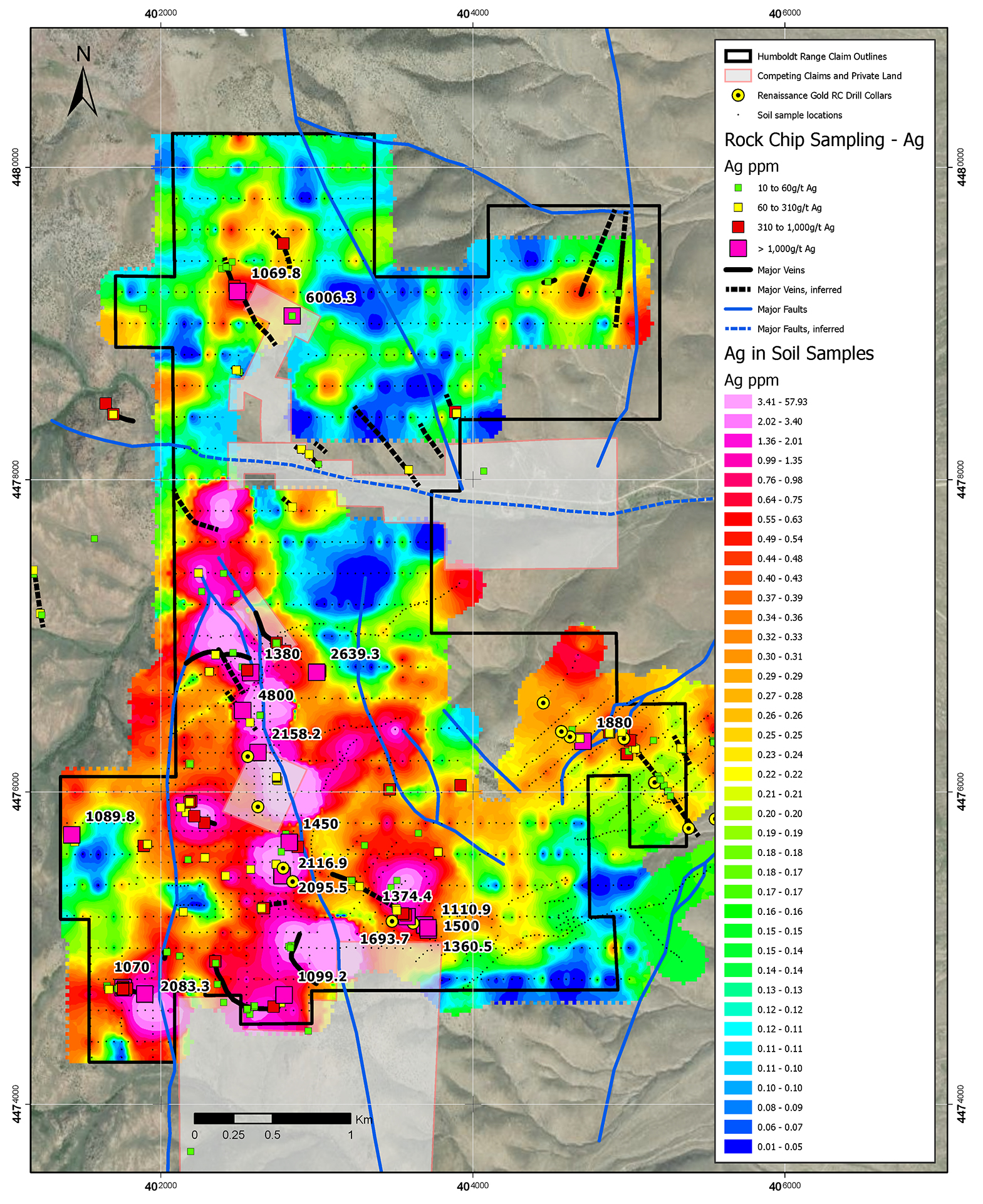
Figure 2. Gridded image of silver in soil sampling overlain with rock-chip sample assays, labelled where >1,000g/t silver.
Gold
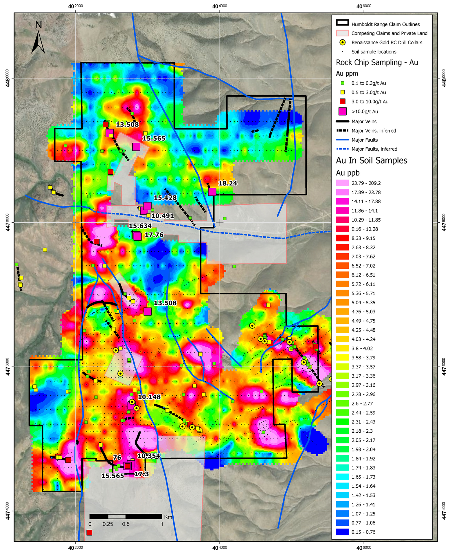
Gold is also highly anomalous in the soil sampling in the Arizona Graben, particularly along the fault margins (Figure 3), also with strong supporting rock-chip samples from veins, with several samples over 10g/t gold, including a maximum of 76.0g/t.
There are also several other gold anomalies delineated in the soil samples. In some cases, these can be related to known veins and structures, but in other cases (for example, the extreme SE of the sampling grid), the gold anomalism represents new, previously undiscovered targets with no known surface expression (Figure 3 below).
Figure 3. Gridded image of gold in soil sampling overlain with rock-chip sample assays, labelled where >10g/t gold.
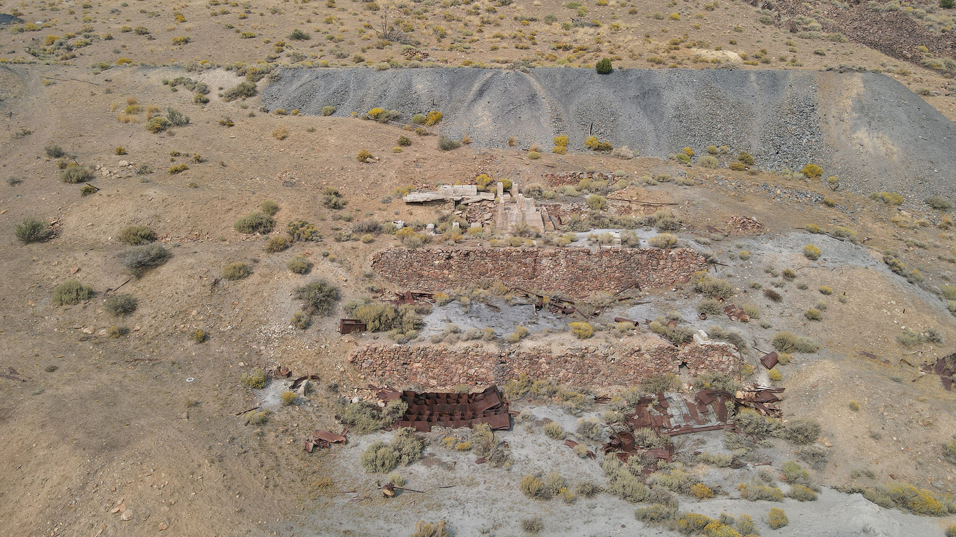
Fourth of July, Historical Workings
